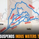
There are many great engineering achievements in the country, but one that stands out is Indian Bhakra Nangal Dam. The construction of a multipurpose dam on the Sutlej River serves as an important asset to India in water and hydroelectricity. This article will map out the geographical area of the dam, its significance and discuss the use of maps in interpreting its characteristics along with some of the major features in the vicinity.
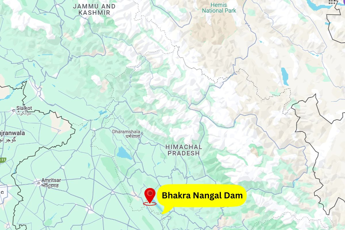
Bhakra Nangal Dam, located between Bilaspur district of Himachal Pradesh and Rupnagar district of Punjab, was built up across the river Sutlej, forming one of the largest reservoirs in India, the Gobind Sagar. This dam’s coordinates are 31.4161° N latitude and 76.4322° E longitude. Maps are of great importance in understanding the location of Bhakra Nangal Dam because of the following reasons:
Maps provide comprehensive information about the structure, service areas, and purpose of the Bhakra Nangal Dam. Listed below are the main features represented by the maps:
The topography of the area includes maps that reveal the various geographical features of the dam, which are:
These maps are important for determining the water dynamics of the Sutlej River and the consequences of the flood control system to the parts around it.
According to these maps, the states and districts that benefit from the dam are shown.
Infrastructure maps illustrate the layout of the dam, and it’s ancillary includes:
Tourism maps showcase attractions around the Bhakra Nangal Dam, such as:
The dam’s maps are integral to:
Maps showing the situation of powerhouses and distribution lines enable the uninterrupted functioning of the power system and electricity delivery.
In the event of emergencies, maps are crucial for:
Maps help identify:
The Bhakra Nangal Dam and its localisation are among the most sought-after travel sites for the regions’ tourists. Maps assist tourists in navigating the following:
For instance, the Gobind Sagar Lake, which is formed behind the dam, is a great place for water sports such as kayaking, jet skiing, and parasailing, and maps enable tourists to easily find where all these activities take place.
In recent years, Geographic Information Systems (GIS) have revolutionised the mapping of Bhakra Nangal Dam. GIS tools offer:
These advancements make the dam’s management more efficient and environmentally sustainable.
Despite its benefits, the Bhakra Nangal Dam has faced challenges, many of which are visible through maps:
The Bhakra Nangal Dam Map is a vital tool in India, and using it in conjunction with other tools is important because it does not only serve the purpose of locating a place. The scope of maps includes the dam’s many functions, including satisfying irrigation and electricity needs, enhancing tourism, and furthering ecosystem purposes.


